
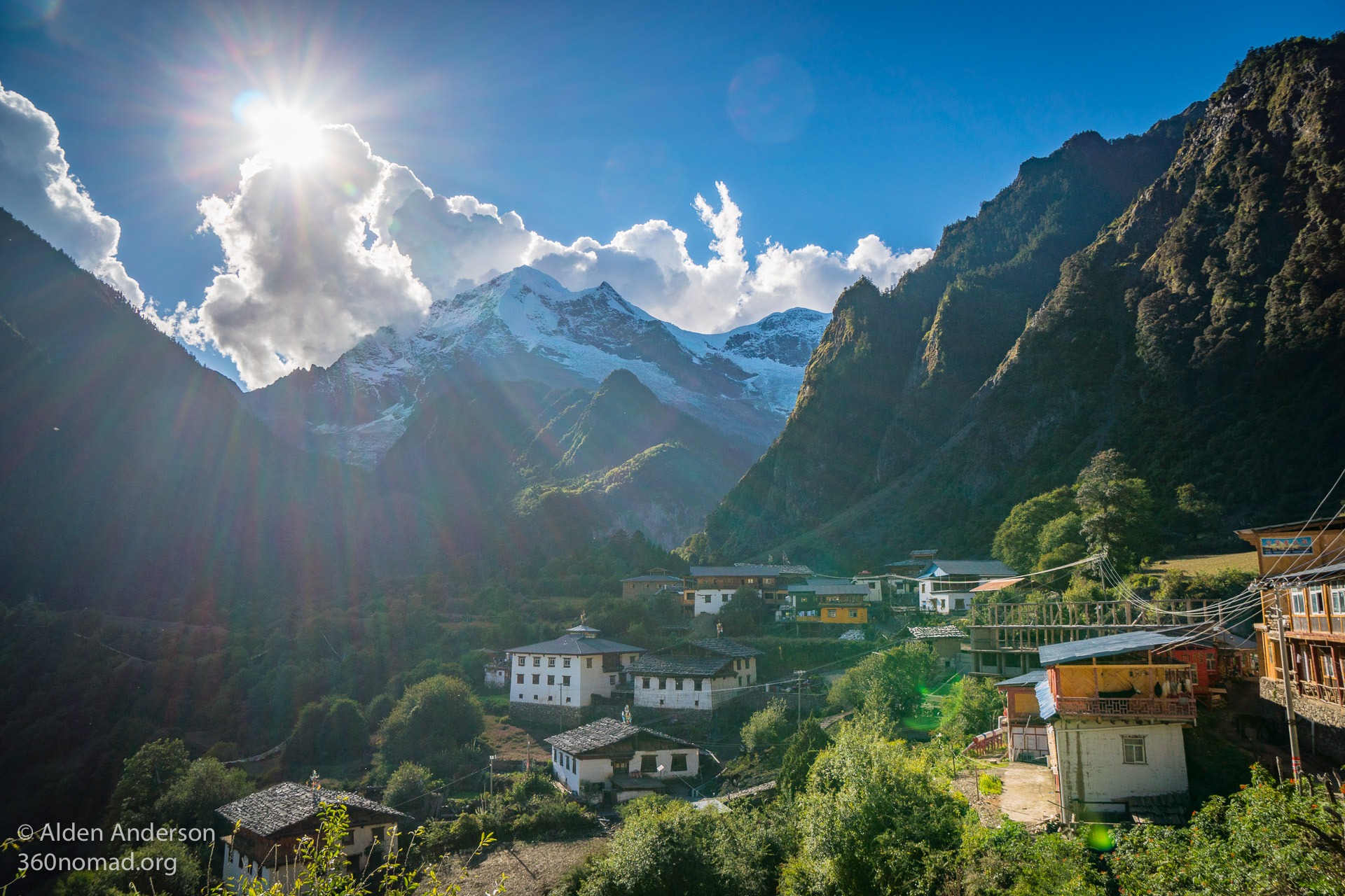
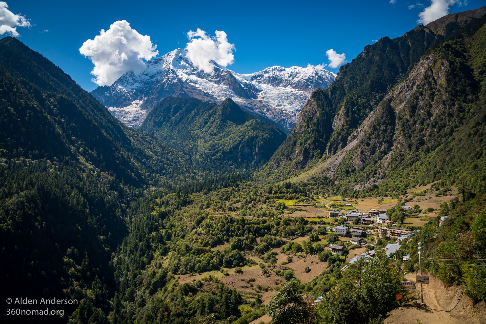
Upper Yubeng Village beneath Bawu Bameng Peak 5,000 m (16,404′)
Introduction to Yubeng Village, China
Nestled in a farming valley in China on the border of Tibet, amongst lush green forests, surrounded by rugged glacier covered mountains lie the 2 small villages of Upper & Lower Yubeng. There is a dirt road that goes to the village, however, you must hike in (or take a mule for the less walking inclined “hikers”). The valley is amazingly beautiful with spectacular views of the mountains, alpine hikes to waterfalls and glaciers, but sadly can also be quite trashed on the trail. The towns have a rural farming feel even if at least half the building are guesthouses or restaurants. It’s well worth the trip and in the approximately 4 months I’ve been in China so far, this offered the best wilderness experience.
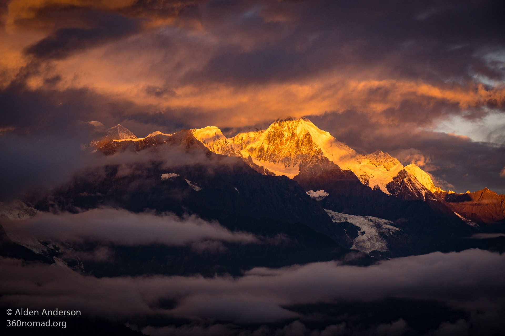
Sunrise over Meili Snow Mountains viewed from Feilaisi
Contents
- 1 Introduction to Yubeng Village, China
- 2 Helpful things to know
- 3 Getting to Yubeng
- 4 Hiking to Yubeng Village from Xidang
- 5 Yubeng Valley
- 6 Hikes in the Yubeng Valley
- 7 Leaving Yubeng Village
- 8 Back to Civilization — Feilaisi to Shangri-La
- 9 Maps of Yubeng:
- 10 Legend of Yubeng Village
- 11 Yubeng Village Tour
- 12 Additional Links
Helpful things to know
Time required: 4–6 days
(from Shangri-La — Includes 2 travel days)
Entrance fee: 69 RMB
Yubeng Village Complete Itinerary:
Day 1: Bus from Shangri-La to Daqin, Continuing onto Feilaisi (5 hours). Stay in Feilaisi one night.
Day 2: Van to Xidang (~1 hour). Hike from Xidang to Feilaisi (5 hours — including over-priced lunch) Stayed in Upper Yubeng
Day 3: Hike from Upper Yubeng to Glacial Lake (5 hours hiking — round trip + 2 hours at the lake) Stayed in Upper Yubeng
Day 4: Hike to Sacred Waterfall (7 hours total — Which included a stop at the “meditation cave” and rest stops) Stayed in Upper Yubeng
Day 5: Hike from Upper Yubeng to Ninong (A bit over 5 hours — Included lunch and breaks) HIGHLY recommended to hike out to Ninong and NOT back to Xidang! Shuttle from Ninong to Feilaisi (1 hour)
Day 6: Ride from Feilaisi to Daqin. Bus to Shangri-La (5 hours)


Pro Tip: Bring snacks (and instant coffee) with you from Shangri-La or Feilaisi. The prices for snacks in Yubeng can be marked up as high as %1000! Although strangely the food at restaurants while marked up isn’t outrageous (about 30–40 RMB for meat dishes).
Caution: DO NOT go to Yubeng from Oct 1–3. This is the start of the Chinese National Holiday (October 1–10) and as I’ve been told there are some 3,000 eager tourists descending upon these two small villages. Beds will fill up and people have been known to have to leave on mule back in the dark. If this is the only time you’ve got and really want to go try to get to Yubeng as early in the day as possible or bring a tent/sleeping bag.
Getting to Yubeng
From Shangri-La:
Take a bus to Deqin (58 RMB) approximately 4 hours. Buses leave throughout the day. Your hostel/hotel can help you with the timetables if you want to take the earliest bus. To get to the bus station in Shangri-La (“Xianggelila Busterminal” on Maps.me) take bus # 1 heading North from Old Town.
When you arrive in Deqin the bus may continue onto Feilaisi (another 15 minutes) for 5 RMB. If not catch a minivan or car. It shouldn’t cost more than 20 RMB.
Feilaisi
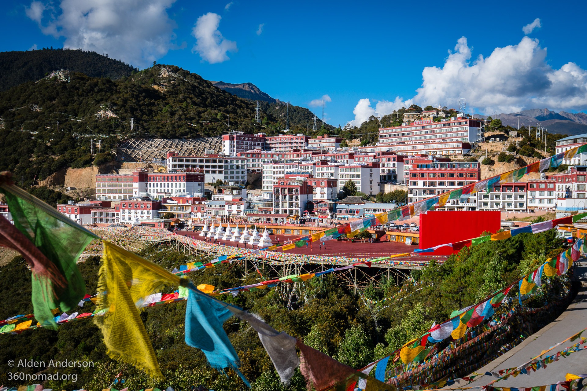
Tibetan styled Feilaisi a good place to stop on the way to Yubeng Village
For the detailed guide on Feilaisi click here
I think Feilaisi is a worthy place to spend the night as there is a chance to see a spectacular sunset and sunrise over the Meili Snow Mountains. It’s some of the most beautiful light I’ve seen. Truly, it’s a unique interplay of golden or pink light in and out of the clouds and across the glaciated peaks. The Chinese have a name for the first light at sunrise “Ri Zhao Jin Shan” which means “The sun rises and shines up above the mountains like gold” (Thanks Jing for explaining this to me).
The town itself (when viewed from afar) is quite picturesque with all of the buildings painted in the same Tibetan style of white and Maroon. Although as far as I can see the town is mostly guesthouses/hotels a few stores & bars and restaurants.
You can stock up on snacks for the hike at one of the small stores in town.
Lodging in Feilaisi
I freaked out a little as I couldn’t find many lodging options on booking but there are a few hostels in the 30 RMB range. I stayed in Feeling Village Youth Hostel which is a 5‑minute walk downhill from where the bus drops you off. You’ll see a sign in a driveway on your right.
Feeling Village Youth Hostel
30 RMB — Dorm Bed
0887–8416133
Decent place though the wall are super thin and the level of hygiene in the bathrooms have something to be desired. On site restaurant with good affordable food. Tripadvisor review
There is another hostel down a side road next to the Regalla Resort and Spa near the bend in the road.
Feilaisi to Xidang
Xidang is where most people start the hike to Yubeng. It is also possible to start the hike in Ninong (described at the end of the page in “Leaving Yubeng Village”) In Feilaisi there are usually vans on the street in the morning leaving to Xidang (a little over an hour drive). Expect to pay 20–30 RMB if the van is full (possibly a little more if there aren’t many people). Or you can arrange a car/van with your hotel/hostel. There is a bus from Feilaisi to Xidang that leaves from the viewing platform area between 8–8: 30 am if there are enough people who need to go to Xidang (I’m not sure what or how this is determined). 20 RMB.
The van will stop at the entrance gate to the region where you will pay 69 RMB (64 + 5 for some kind of insurance). If you are under 25 and have a student ID you should be able to get a %50 discount. (I’ve heard of people using any kind of card with their picture as a “Student ID” of course it can’t be in Chinese).
If you want to start the hike early and avoid Feilaisi I’ve read that it is possible to stay in Xidang (Xidang Hot Springs) for 50 RMB. So if you arrive in Feilaisi early in the day and don’t care to see sunset or sunrise over the Meili Snow Mountains and want to check out the hot springs you can get a ride to Xidang, stay there and start your hike early the next morning.
Pro Tip: Leave your heavy luggage in Shangri-La or Feilaisi and bring the minimal gear you’ll need for your stay in Yubeng.
Hiking to Yubeng Village from Xidang
Distance: 18 Km (11 Miles)
Elevation Gain (Total): 1,100 m (3,600’)
Start Elevation: 2635 m (8,645 feet)
Highest Elevation: 3,729 m (12,234 feet)
Time: 4–7 hours
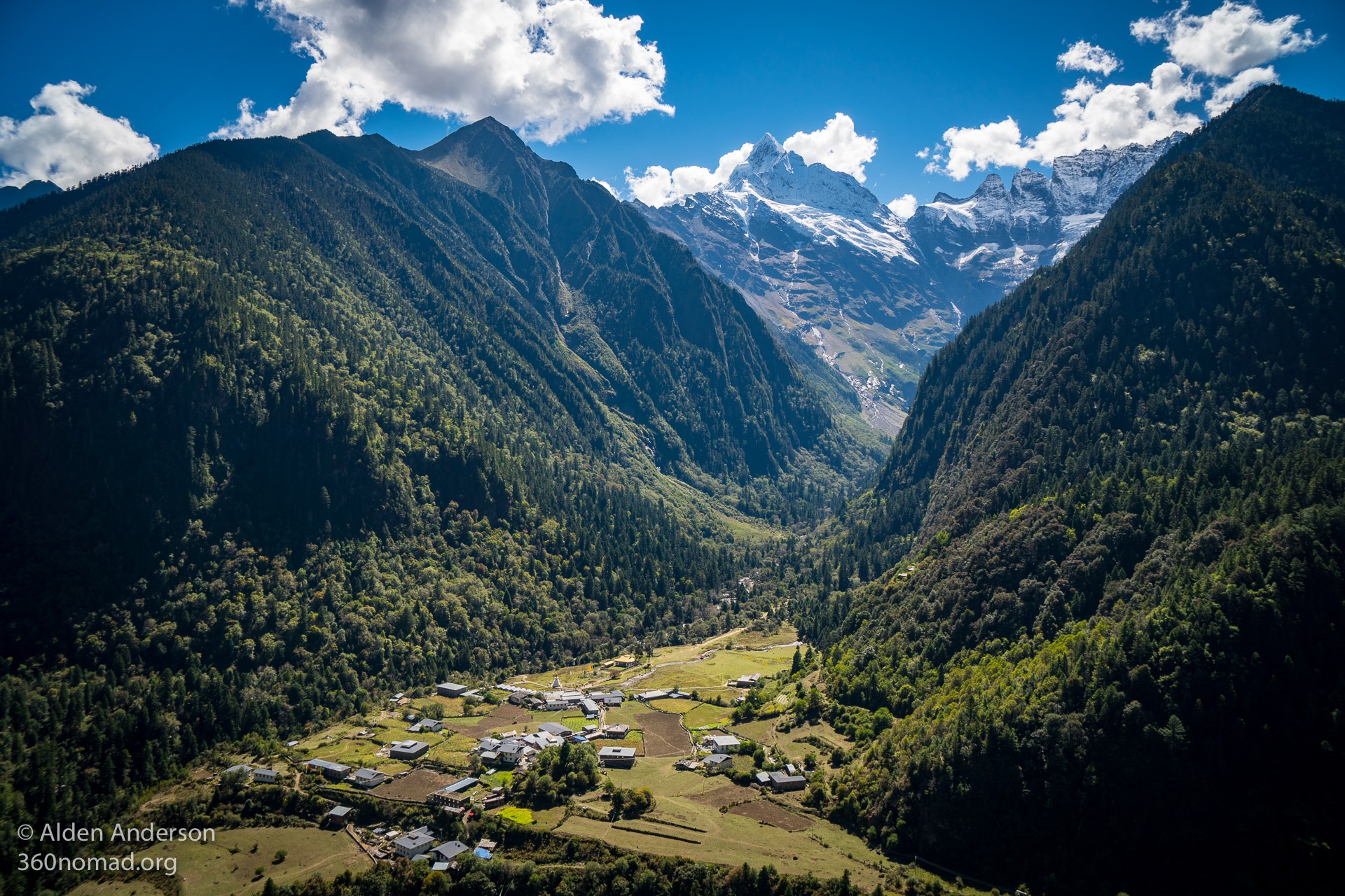
Upper Yubeng Village on the trail from Xidang
A Note on Altitude
The highest point on the hike into Yubeng is the Nanzheng (Nanzong) pass at 3,729 m (12,234 feet). So you will need at least a few days (more for some people) before this to acclimate. If you are feeling the effects of altitude (headache, shortness of breath, dizziness or light-headedness, loss of appetite, nausea or vomiting, rapid heart rate) take it slow with many breaks. Do not over-exert yourself even if you are extremely fit. AMS (Acute Mountain Sickness) affects everyone differently no matter your fitness level. If you have been in Lijiang, Shangri-La, and Feilaisi for 4–5 days already you may be acclimated but pay attention and pace yourself. Small bottles of oxygen are available for sale in Shangri-La, Feilaisi, and Yubeng. More information on AMS.
The van will drop you off right at the trailhead with a bunch of Mules waiting for those “hikers” who have an aversion to hiking. The hike is on a dirt road the entire time through the forest with mules, (when I went) trucks carrying people to fix/maintain the dirt road and possibly hikers who haven’t discovered the seemingly little-known invention of headphones. There are 3 places to stop and eat on the hike as well as some viewing platforms and bathrooms. There is pretty much no way to get lost and there are big wooden signs with maps in English along the way.


The food on the hike in is extremely overpriced (I ate at the Nanzheng Col and agreed to pay what I thought was “15 RMB” for a bowl of soup and a bowl of rice. To my utter shock and disbelief (my jaw literally dropped) it was 50 RMB!!! when I went to pay. Needless to say, had I known this before I happily ate the soup from the kitchen of fairly questionable cleanliness, I would’ve just waited another 30–40 minutes until I arrived in Yubeng Village, where the food is more expensive than normal but not 50 RMB for soup! I should’ve asked for more!
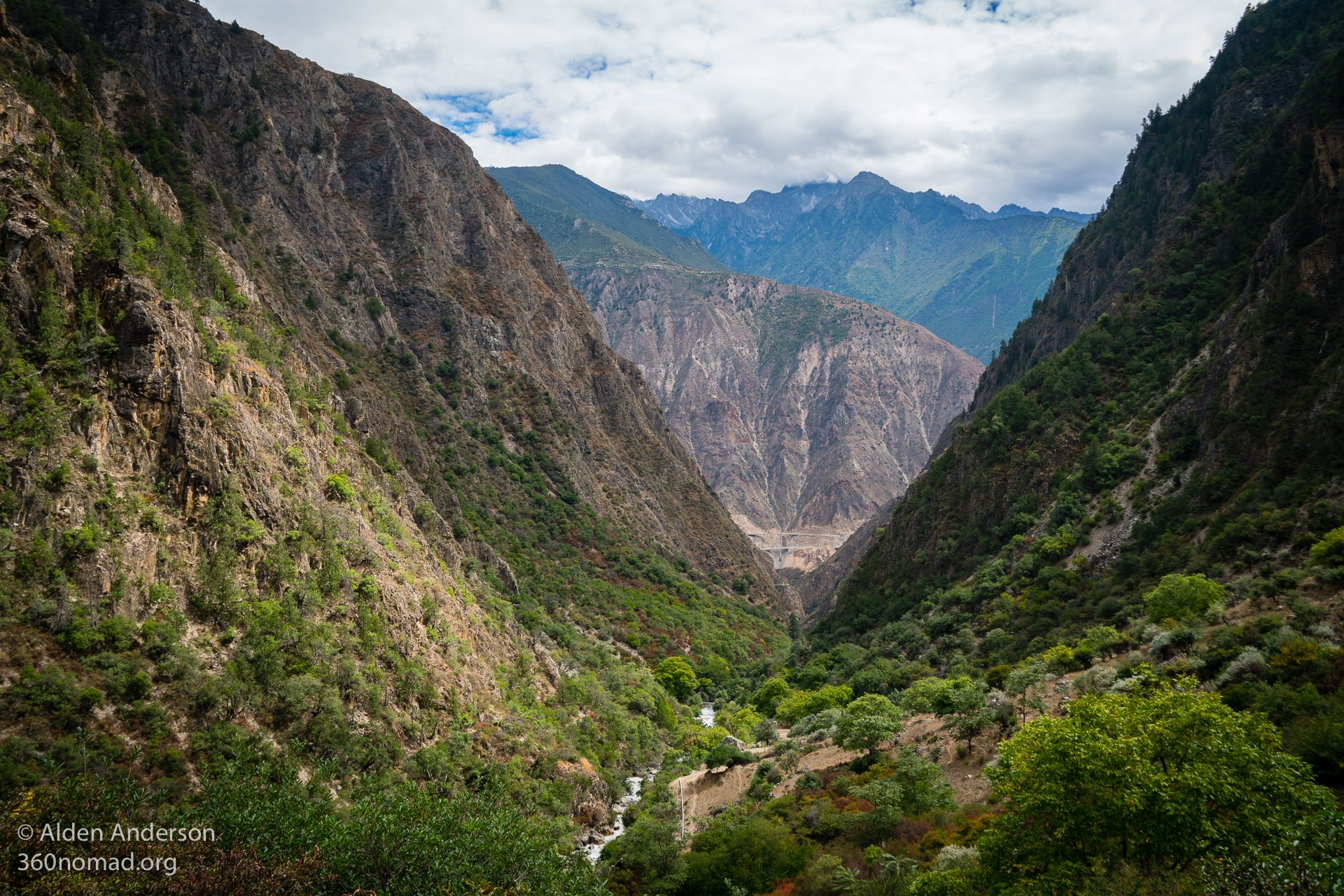
It’s all uphill through the forest with a few views of the gorge you see from Feilaisi, as well as views of Feilaisi perched high up on the other side of the canyon. The real views are after you top out at the Nanzheng Col 3,729 m (12,234 feet) and begin descending into the picturesque Yubeng Valley. Don’t miss a wooden viewing platform that gets you above the trees and (mostly) above the ubiquitous telephone lines for great views of the village and valley.
There are lots of paths and roads going down crisscrossing each other but they all seem to go to Upper Yubeng Village. You’ll pass a building where they will check your ticket as you descend into the valley. Some people get charged 5 RMB here (They didn’t ask me) but they will give you a ticket and you can use it to get a discount of 5 RMB from your hostel.
Yubeng Valley
Lodging — Upper Yubeng


There are many lodging options in Both Upper and Lower Yubeng. If it’s not the beginning of October (1–3) you shouldn’t have any trouble finding a place. No need to book in advance. If there aren’t many people there it’s a buyers market, so try to bargain your rate down or get a private room for cheap! I stayed at MeDo International Youth Hostel.
MeDo International Youth Hostel
18008877518
Dorm Bed 40 RMB
Has some nice swing seats inside and outside with amazing views of the valley! Nice hot showers! On my third night, I had the 4‑bed dorm to myself.
WiFi:
It may not have been the case in the past but wi-fi worked well at my hostel (unless it’s the evening and lots of people are using it) and at the restaurants I visited. I even got basic internet on my phone (China Mobile) hiking to the lake and sacred waterfall at various points.
Lodging — Lower Yubeng
I didn’t stay in lower Yubeng but I passed more than a few guesthouses when walking through.
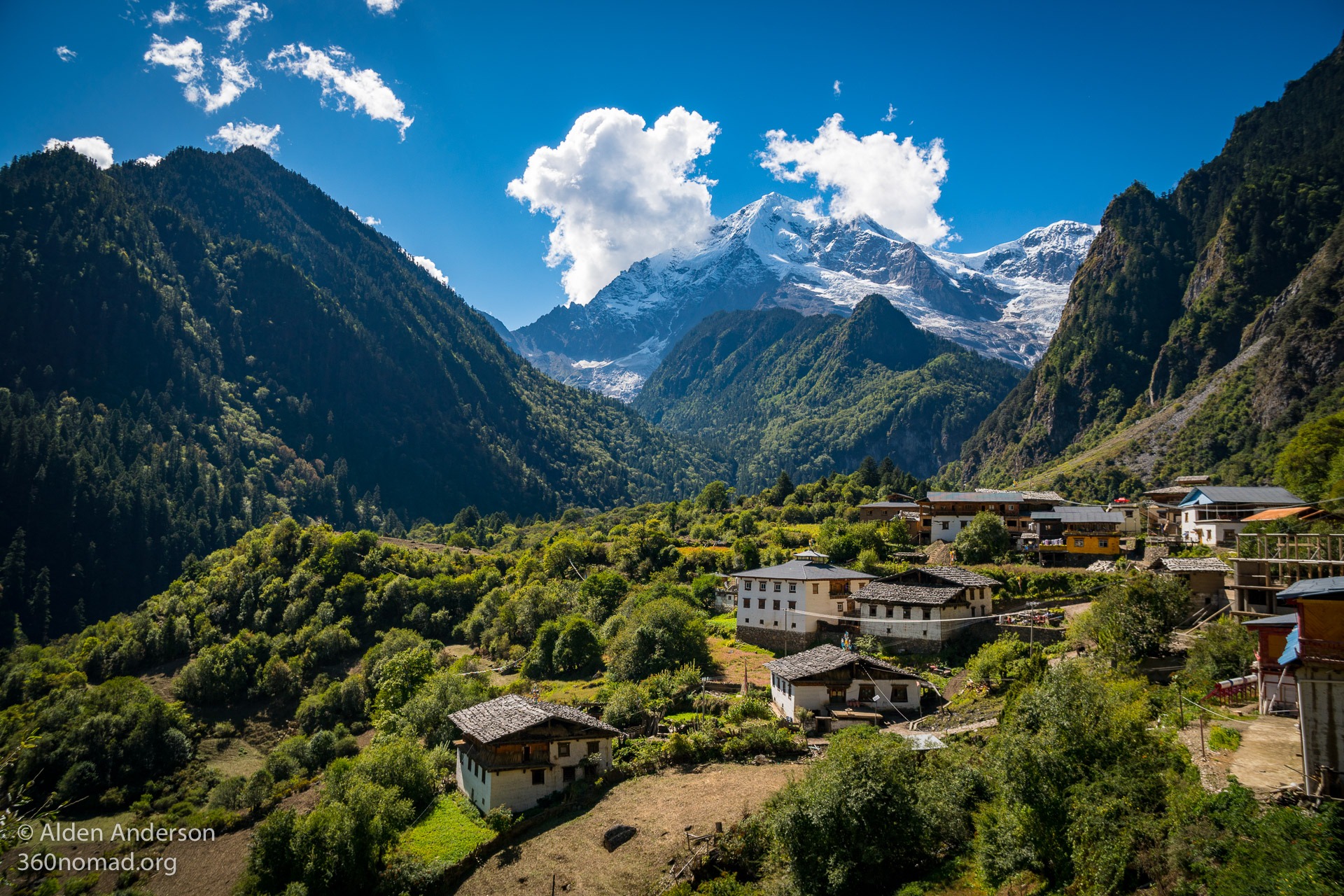
Upper Yubeng Village vs. Lower Yubeng Village
Lower Yubeng Village
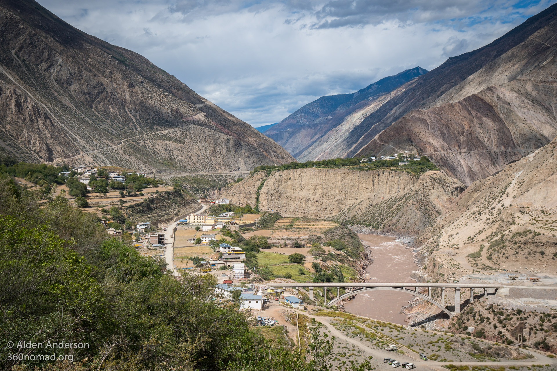
Walking from Xidang you will arrive first in Upper Yubeng Village. It has better views of the snowy mountains, more options of guesthouses and more people. Lower Yubeng might be little quieter with a bit more of a farm village feel. It also has 2 small Buddhist monasteries. If you are hiking to the glacial lake Upper Yubeng is closer (probably saves you 1.5 hours of hiking) Lower Yubeng being closer to the sacred waterfall hike. I stayed in Upper Yubeng for three nights and loved it. Knowing what I know now I might’ve opted to stay my last night in Lower Yubeng as it saves time on the waterfall hike and is closer if you are exiting via Ninong (HIGHLY recommended).
If you decide to hike in from Ninong you’ll arrive at Lower Yubeng Village first.
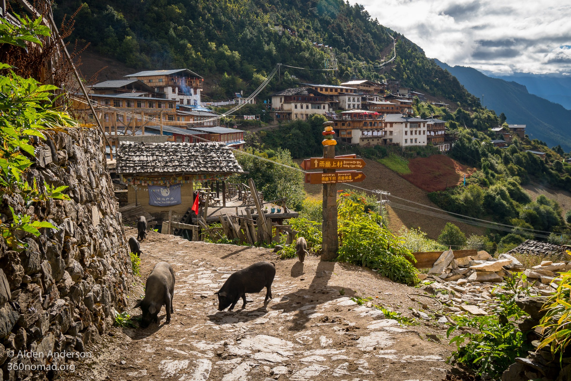
Pigs roam freely in Upper Yubeng Village
Hikes in the Yubeng Valley
Glacial Lake and Base Camp:
Distance: 11.6 km (7.2 miles)
Elevation Gain: 793 m (2,600′)
Start Elevation: 3,228 m (10,590′)
Highest Elevation: 3,900 m (12,800′)
Time: 5–8 hours
(Starting from Upper Yubeng Village)

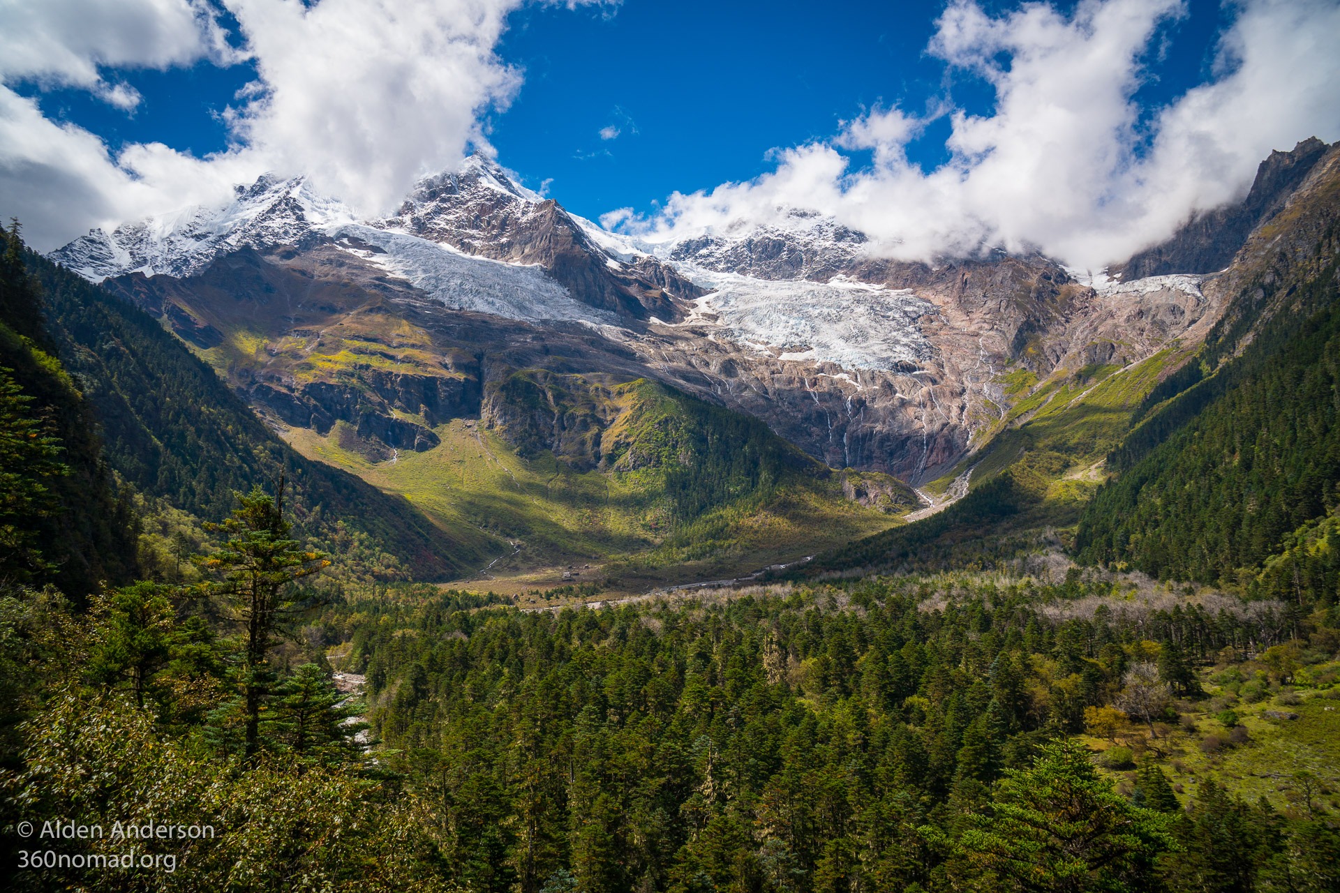
Glacial Lake above Yubeng — 3,900 m (12,800′)
A beautiful emerald-green glacial lake with many waterfalls cascading down from the glaciated peaks above.
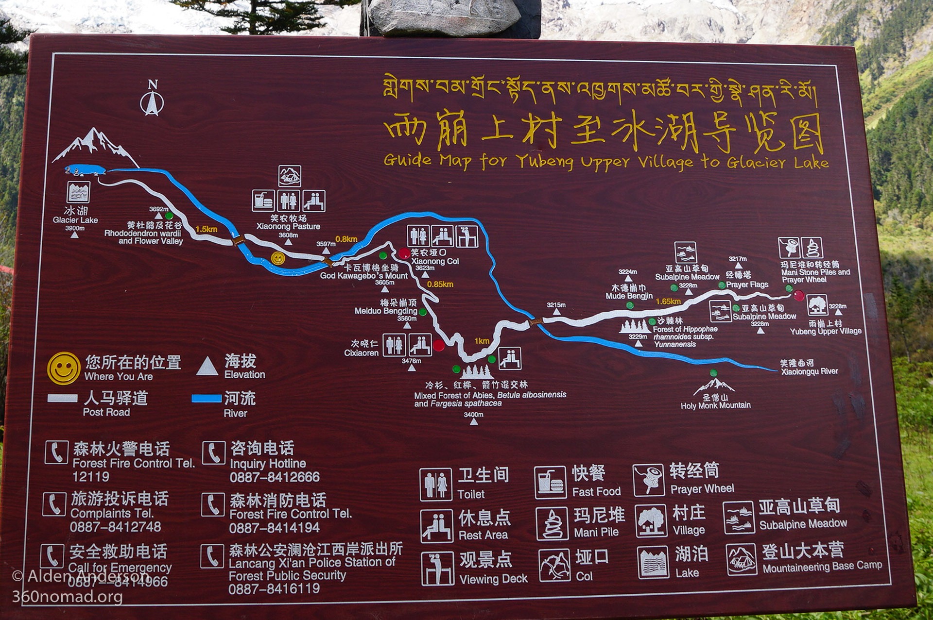
Hiking Map for Glacial Lake Hike
In Upper Yubeng Village follow the main path heading West out-of-town, passing the white stupa on your left. The trail is well-marked with wooden signs and maps showing you where you are and which direction to go. The path winds through the forest before crossing the first bridge over the river and climbing steeply uphill through the trees (trails can be quite muddy). The uphill is continuous until you top out at the Xiaonong Col at 3,623 m (11,886′) where you will be rewarded with beautiful views of the valley ahead… and trash.
View from Xiaonong Col on the way to the Glacial Lake
Continue down the viewing platform crossing the river again, shortly after arriving at Xianong Pasture and Base Camp. You can get something to eat here. It’s another 1.5 km uphill to the lake.

Glacial Lake Selfie
Passing litter on the trail up to the lake past a holy rock covered with money it culminates at a beautiful viewing spot (covered in trash) overlooking the pristine lake and fresh glacial melt flowing down in a myriad of waterfalls. If you have time walk over to the waterfalls and ponder the fact that this water will go on to form the borders of Myanmar, Laos, Thailand, Cambodia and Vietnam flowing to the mighty Mekong, the world’s 12th longest river.
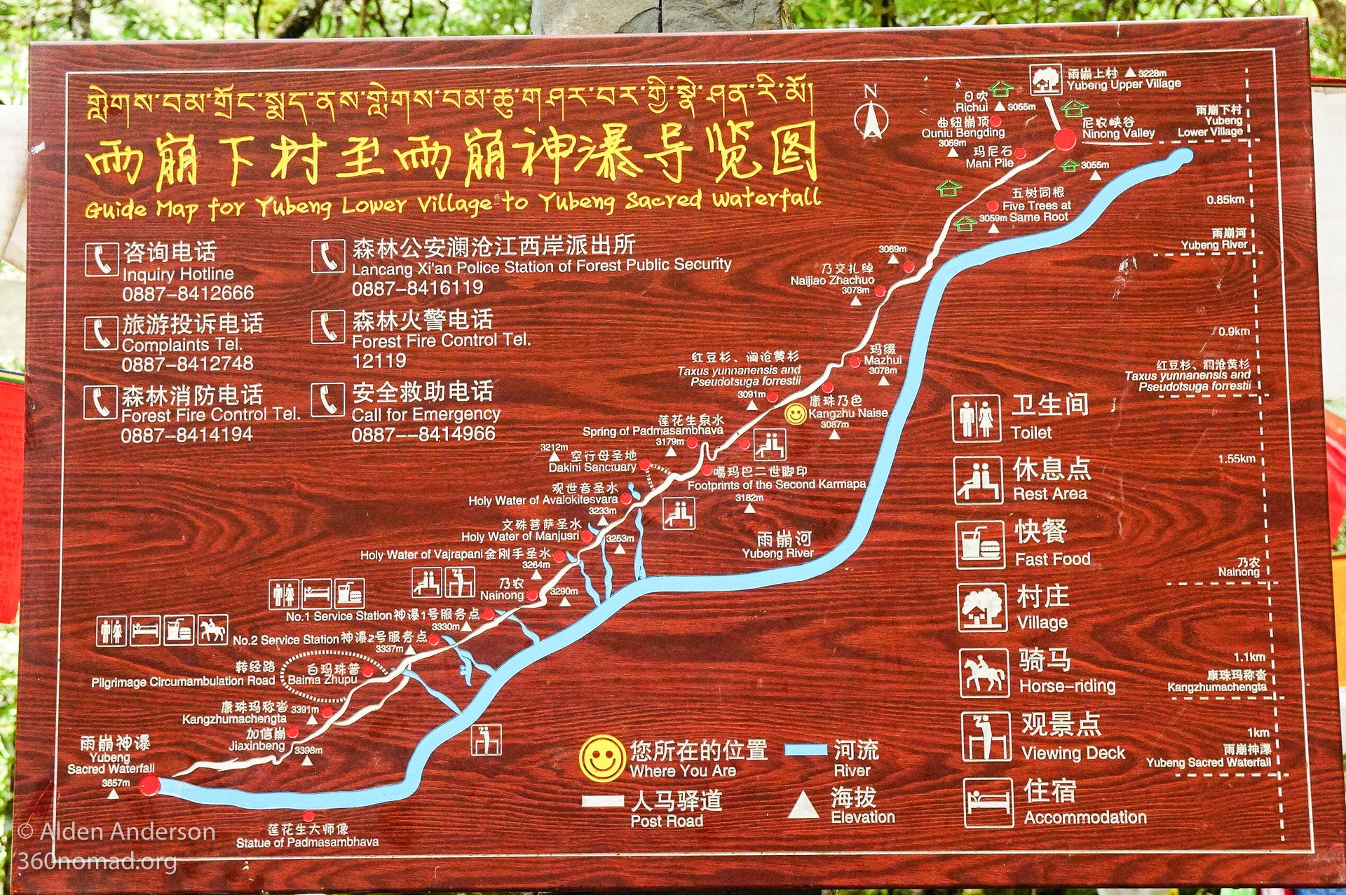
Shenpu 雨崩神瀑 (Yubeng Sacred Waterfall):
Distance: 12.8 (8 miles)
Elevation Gain: 775 m (2,540′)
Start Elevation: 3,228
Highest Elevation: 3,657 m (12,000′)
Time: 5–7 hours
(Starting from Upper Yubeng Village)
A pleasant hike through a beautiful forest lined with prayer flags, into a high alpine valley surrounded by glaciated peaks to a mist of a waterfall (when I visited) with trash strewn about (holy trash?).
Hiking Map for Sacred Waterfall Hike


“It’s easier than the hike to the glacier lake” Everyone seems to repeat. Well, hiking from Upper Yubeng you must hike back up the 173 meters (567 feet) from Lower Yubeng at the end of the day, making it a somewhat similar hike in terms of effort. However, if you are staying in Lower Yubeng you’ll avoid these last 567 morale killing feet at the end of the day.
From Upper Yubeng head downhill following the signs to “Yubeng Lower Village” and “Yubeng Sacred Waterfall” crossing the “Cold-hell Bridge” with the attendant sign explaining why it’s named as such. Walking through Lower Yubeng you’ll pass the Sidh Ribeng Monastery in the middle of town and a white stupa (on your left) and the larger though seemingly unused Quinu Bengding Monastery as you exit town.
This next section of the hike through the forest with a river to your left is quite peaceful and beautiful with moss-covered rocks and trees, prayer flags blowing in the wind.
Before long the path starts to ascend though it’s a beautiful forest and the trail seems to be on a better gradient (not as steep uphill) compared to the hike to glacier lake. Signs mark the various holy sites along the way.
The upper valley would have beautiful views of the peaks surrounding you but today they’re in the clouds.
You’ll pass some small buildings where you can eat and probably sleep and use the restroom. Further along the trail there is a sign for a “Meditation Cave. If you want to visit the cave don’t turn right at this first sign as the trail is slippery and steep. A little further along there’s another sign where you’ll turn right, following a side trail to the “meditation cave”. (Or you could visit on the way down from the falls).
From here it’s a steep section up to the falls, passing a large rock with an interesting sign telling of an ancient inscription (I couldn’t find it) and a wall of money, opposite a bunch of clothes hung on some branches. Further along the trail is another holy site covered with trash where a sign tells you to “keep quiet”.
It’s common to see people bathing in the waterfall, and perhaps if there was a little more water and wasn’t getting dark I might’ve as well.
After hiking in these extremely beautiful wilderness areas and seeing so much trash I would urge you take all of your trash out with you. I know if you’re reading this you are probably one of the responsible ones but even using the trash bins on the trail seems to not be workable as so many times they are overflowing.
Leaving Yubeng Village
You have two options. Hiking out via Ninong which is a far better hike along a gorge, through the trees with fewer horses/mules, no trucks and some beautiful scenery. Or you can hike back out to Xidang on the same dirt road you hiked in on. You should note that it is also possible to hike in via Ninong though it is longer with over 2,000′ more of elevation gain compared to hiking in from Xidang but would make for a quieter more beautiful hike.
Hiking out via Ninong
4–6 hours, mostly all downhill.
Views down the gorge from Yubeng to Ninong
The trail out via Ninong is much more pleasant as it’s a narrower trail (not a dirt road), follows the river passing a beautiful waterfall coming in from a side gorge, is mostly all gradual downhill and ends with a hike along a gorge reminiscent of Tiger Leaping Gorge (on a much smaller scale). (The trail is marked on the Maps.me app, as are the other trails in the area, just ensure you download the map beforehand as cell service is quite unreliable in and around Yubeng.)
From Lower Yubeng turn left at the large white stupa, cross the river/stream and continue down the trail paralleling the river.
From Upper Yubeng you can either walk down to Lower Yubeng turning left at the stupa as described above or follow the trail leaving Upper Yubeng and staying on the East bank of the river for the first portion of the hike before joining the main trail when it crosses the river to the West side.
The trail meanders downhill along the river for some time (passing two places to eat the first of which has a water pipe down to a hydroelectric generator — fun fact). Shortly after passing the second and last place to eat the trail crosses the river.


 river")
After crossing the river the trail follows a narrow gorge with a 200–300 foot drop-off on your right. The trail is wide enough however and I didn’t feel in danger of falling even when mules and then two motorcycles passed checking on the water trough delivering (drinking?) water to Ninong.
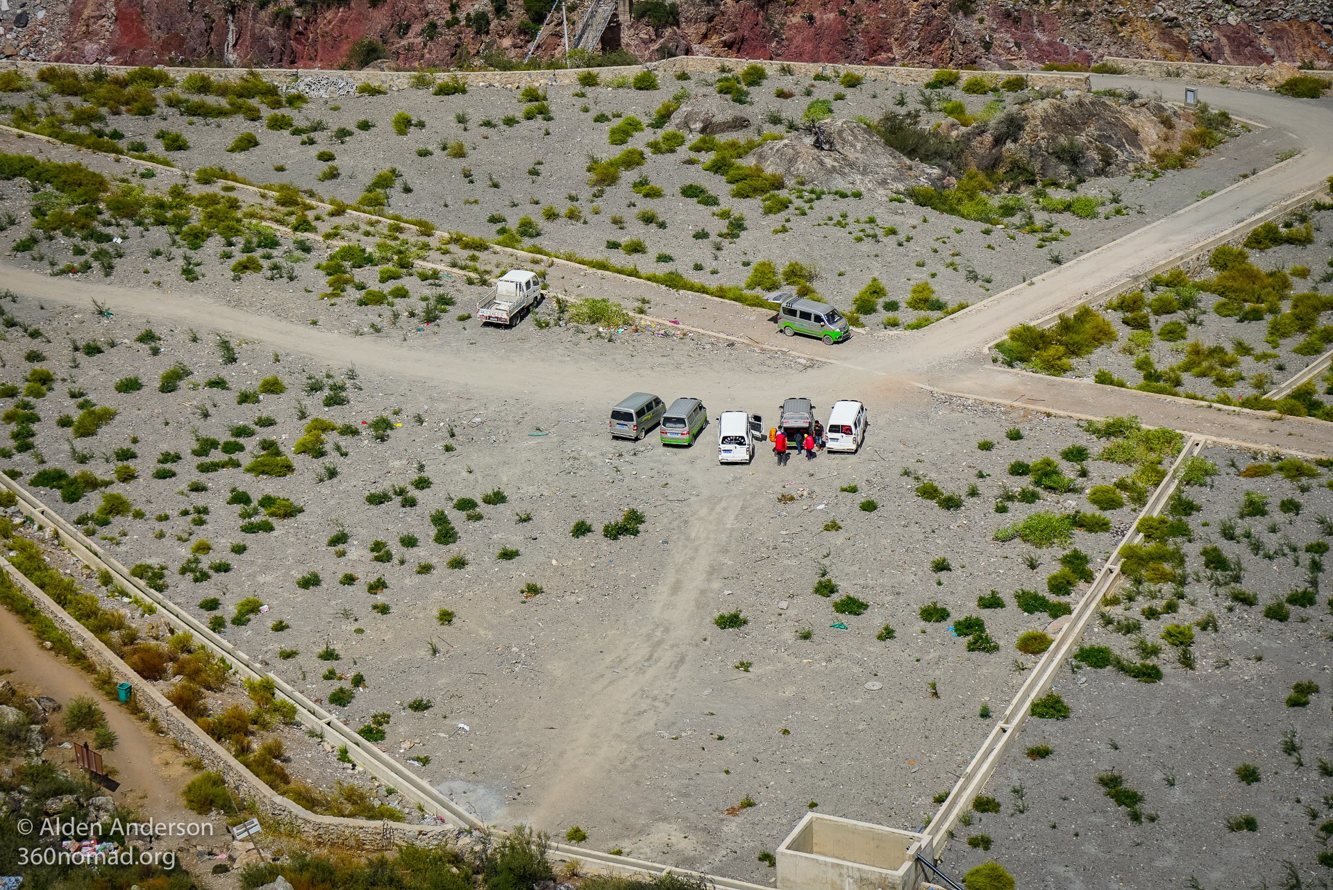
Soon you’ll be looking down on the muddy Mekong river far below you. It’s a short walk to Ninong, the small town in front of you. A small trail leaves the main trail descending to a parking lot where vans wait to collect hikers returning to Daqing or Shangri-La
Eating on the hike out
There are 2 places to eat along the way. I stopped at the second near the end overlooking the gorge, just before the trail winds around the mountain to Ninong. It was reasonably priced food (30 RMB for tomatoes with eggs and a bowl of rice) with a store and a very friendly man serving food. I believe you can sleep here as well.
Back to Civilization — Feilaisi to Shangri-La
A van from Ninong back to Daqing usually costs 150 RMB (for the entire van) and takes about an hour. During the Chinese National Holiday, this price goes up to 210 RMB. Buses leave from Daqing to Feilaisi throughout the day until around 2:40 pm — 5 RMB. If you miss it you can take a car for 10–20 RMB (about 15 minutes)
Ninong viewed from the trail
There are also vans going back to Shangri-La. 100 RMB per person if the van is full. If you’re planning on returning to Shangri-La after your hike you might consider leaving your extra luggage there instead of Feilaisi so you can get a van directly back to Shangri-La from Ninong instead of returning to Feilaisi, which will save time and money.
Vans waiting in Ninong
Maps of Yubeng:


Legend of Yubeng Village
“Legend goes that in the old times, Yubeng Village was unknown to the outside world. One day, an old man was found trying to borrow highland barley from Xidang Village near Lancang River. No one knew where he came from, so some people figured out an idea and traced him but in vain because on the way the old man disappeared. Later on, when he came back for more food again, Xidang villagers objected and told him: “we aren’t going to lend you barley or wheat, but just some millet”. When they loaded the food for the old man, some smart guys made small holes on the bags. After he started his journey back home, he was again; but he didn’t realize the holes on the bags had spilled the millets along the way. When he arrived at a huge rock, again he disappeared. So the surprised and uninformed villagers pried up the rock and Yubeng Village was discovered.”
